


Editor’s Note: This is part two of the fifth article in an occasional series profiling the river basins of Kentucky.
The Green River Part Two: The Upper River Basin

The upper Green River (Photo from Green River Nature Conservancy)
The Green River is 384 miles long, arising in the foothills of the Appalachians in Lincoln County, flowing northwestward through central and western Kentucky to its confluence with the Ohio River near Spottsville, in Henderson County.
The Green River basin drains 9,430 square miles. It is the longest tributary to the Ohio River in Kentucky that is solely within the state.
In this article the upper basin is defined as the Green River upstream of Morgantown, in Butler County.
Upper Green River Tributaries
The four largest tributaries in the upper Green River basin include:
• The Nolin River is 104 miles long, arising in western LaRue County, and flowing southwestwardly through or along the boundaries of Hardin, Grayson, Hart and Edmonson counties. It joins the Green River in Mammoth Cave National Park, about two miles northeast of Brownsville.
• The Barren River, the largest tributary to the Green River, is 135 miles long, arising in Monroe County and flowing into the Green River, in northwestern Warren County on the Butler County line.
• The Little Barren River arises in Metcalfe County, and flows northward along the Hart / Green County line, joining the Green River north of Monroe, in Hart County.
• Russell Creek arises in Russell County near Russell Springs, and flows northwestward through Adair County, joining the Green River south of Greensburg, in Green County.
Lakes and Parks

Nolin River Lake (Photo from Flickr Commons)
• Nolin River Lake is in Edmonson, Grayson, and Hart Counties, about 17 miles south of Leitchfield.
The dam is on Ky. 728, 7.8 miles upstream from the Nolin River’s confluence with the Green River.
The lake is just a short drive from Mammoth Cave National Park, one of Kentucky’s most popular tourist attractions.
Construction started in January 1959 and the lake was completed in March 1963.
The main access highways are Ky. 259, Ky. 88, and Ky. 1827.
The 5,795-acre reservoir is 39 miles long and has 172 miles of shoreline at summer pool, elevation 515.
The drawdown to winter pool, elevation 490, reduces its size to 2,890 surface acres.
Nolin River Lake is 75 feet deep just above the dam, and the lower lake has an average depth of about 30 feet.
Above Wax, the lake is much shallower, with an average depth of about 15 feet.
Nolin Lake State Park is west of Cub Run, where Ky. 1827 (Brier Creek Road) ends at the lake.
The 333-acre state park opened in May, 2001, and is open year-round, weather permitting.
Facilities include a campground, with 32 campsites with hookups for water and electricity and 27 primitive campsites, a 9.2 mile trail that leads to a waterfall, open to hikers and mountain bikers, a public beach, and a playground.
Call 270-286-4240 for Nolin River information.
Special fishing regulations and information on launching ramps of trailered boats on Noli River Lake
• Barren River Lake is southwest of Glasgow, in Barren, Monroe, and Allen Counties.

Barren River lake (Image from Google Maps)
The lake, which opened in1965, was impounded from the Barren River.
At summer pool, Barren River Lake is 10,000 acres at elevation 552, has 135 miles of shoreline, is 33 miles long and 70 feet deep above the dam.
There is a substantial winter drawdown of 27 feet to elevation 525, which reduces the surface acreage to 4,340.
At winter pool the upper half of the lake is very shallow. The drawdown goes all the way to the pre-impoundment elevations of the old river channel, and miles of mudflats are exposed.
Barren River Lake State Resort Park, open year-round, is about 14 miles southwest of Glasgow, off U.S. 31E. The park encompasses 1,053 acres and was dedicated in 1965.
Facilities include a fifty-one-room lodge, twenty-two two-bedroom cabins, restaurant, pub, ninety-nine-site campground, eighteen-hole golf course, beach and hiking trails.
For Barren River Lake information call 270-646-2151.
• Green River Lake is east of Ky. 55 between Campbellsville and Columbia, in Taylor and Adair Counties.
Construction began in April 1964, and the lake was completed in June 1969.
The dam is 26 miles upstream of Greensburg, and 305.7 miles above the mouth of Green River.

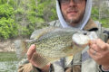
The Green River Lake tailwaters offer some of the best fishing in Kentucky (Photo from KDFWR)
At summer pool (elevation 675), the 8,210-acre lake stretches 25 miles and has 147 miles of shoreline. The average depth is about 25 feet, and at its deepest point, just above the dam, the lake is 65 feet deep.
The winter drawdown of seven feet reduces the lake to about 7,205 surface acres at elevation 668 feet.
There is a big island in the bend of the lake below Smith Ridge.
Green River Lake State Park, open year-round, is south of Campbellsville, off Ky. 55 on the west shore of the lake.
The park opened in 1969 and encompasses 1,331 acres. Facilities include 28 miles of trail for hikers, mountain bikers and horseback riders, a beach, and picnic area.
The campground, open seasonally, has 167 water and electric RV sites and 60 primitive tent sites, a grocery and three bathhouses.
For Green River lake information call 270-465-8255.
• Mammoth Cave National Park, established in 1941, is a national/international treasure.
The national park was designated a World Heritage Site on October 27, 1981, and an international Biosphere Reserve on September 26, 1990.
Mammoth Cave National Park is 52,830 acres, located primarily in Edmonson County, extending eastward into Hart and Barren counties. The Green River runs through the park, with the Nolin River flowing into the Green near the park’s western boundary.

Mammoth Cave (Photo by Kim Shoo, Flickr Commons)
Evidence suggests that Mammoth Cave was extensively explored by Native Americans during the Archaic Period (8000 B.C. to 1000 B.C.) through the Woodland Period (1000 B.C. to A.D. 1000). The historic entrance to Mammoth Cave was discovered in the late 1790s by a hunter trailing a wounded bear.
In 1972 the cave became the longest cave system known in the world after researchers discovered a passageway that linked Mammoth Cave to adjacent Flint Ridge Cave.
The National Park Service offers several cave tours to visitors.
Some notable features of the cave, such as Grand Avenue, Frozen Niagara, and Fat Man’s Misery, can be seen on lighted tours ranging from one to six hours in length.
Two tours, lit only by visitor-carried paraffin lamps, are popular alternatives to the electric-lit routes, and several “wild” tours venture away from the developed parts of the cave, where participants make several crawls through muddy and dusty tunnels.
Other recreational activities at the park include hiking, camping, fishing and nature study.
Complete visitor information for Mammoth Cavve National Park
Fish and Wildlife Resources
The Green River, from the Green River Lake Dam, to the eastern boundary of Mammoth Cave National Park, is one of the most biodiverse stretches of river in the country.
This is due in part to the presence of a large and diverse mussel populations, with a reported 39 species, six of which are endangered. A 26-mile section of the Green River, farther downstream, in Hart and Edmonson counties, has been designated a Kentucky Wild River.
There is a boat launching ramp below the dam, with no fee to launch.
As expected, the tailwaters offer excellent fishing opportunities for cool-water fisheries, especially Walleye and Muskie, but Smallmouth Bass, Spotted Bass, Freshwater Drum, several species of catfish, Sauger, and Largemouth Bass are also present.
The upper Green River features three of the state’s top fishing lakes, all within a relatively short driving distance of one another.
The showcase park in the region, Mammoth Cave National Park, is more that just cave tours. There are 80 miles of hiking trails, three developed campgrounds, 13 backcountry campsites, and excellent opportunities for kayaking and fishing in the pristine, tree-canopied Green and Nolin Rivers.