


Since 1949, the Kentucky Historical Marker program has allowed communities across the state to recognize and share the sites, events, and personalities they consider important to local, regional, state, or national history.
To date, more than 2,400 markers celebrate Kentucky’s complex story and the Kenton County Historical Society has made it part of their mission to add to the number of markers in the county.
The Kenton County Historical Society compiled a list of three possible marker locations. Application packets were completed over a six-month period, with the required three citations to support each “fact” stated on the proposed markers.
The Kentucky Historical Society recently approved two new markers for Kenton County.
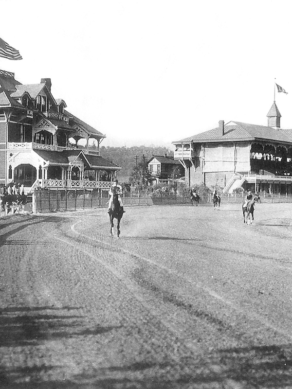
3-L was named in part to celebrate the connection of horseracing tracks in Latonia (pictured), Lexington and Louisville. (Photo from Kenton County Historical Society)
The first marker, recognizing 3-L Highway, commemorates the long and interesting story of one of Northern Kentucky’s most well-known and often-traveled highways. Once known as the Independence Turnpike and now designated KY Hwy 17, this thoroughfare in the 1920s was renamed the 3L (LLL) Highway. Other state roads, including parts of what is now US 60 between Louisville and Lexington, and most of present-day US 27 between Paris and Falmouth, were also given this unique name. LLL was an abbreviated version of the full name of the road, that being the Louisville, Lexington, and Latonia Highway. The purpose of the renaming was to show horseracing fans, jockeys, horse owners, and trainers the best route between the state’s three most popular tracks at the time: Churchill Downs in Louisville, the Association Track in Lexington, and the Latonia Racetrack in Latonia, just south of Covington. While only signed as the 3-L (white signs with blue Ls) from around 1920 to about 1936, residents in Northern Kentucky, especially those in Kenton County, affectionately refer to this major thoroughfare as the 3-L still today. In fact, several cities along the route still include the unusual and historic name on their official street signs. The marker is planned to be placed in the grassy field at Old 17 (the original LLL) and KY 17 in Fort Wright.
The second marker is titled “Ancient civilizations.” This marker is significant to Kentucky history because it celebrates the existence of the many ancient civilizations that once roamed, hunted, and lived in the Northern Kentucky region, with particular attention to Kenton County. Native tribes arrived in this region over 12,000 years ago. The geography and plant life here, after the Ice Age, formed a near-perfect location for these tribes to thrive. Thousands of artifacts and evidence of burial mounds, campsites, and actual communities have been unearthed and researched for decades. The marker is planned for the southern end of Pioneer Park, the actual location of one of the more important ancient civilization sites unearthed decades ago.
Marker applications are reviewed by the Kentucky Historical Society twice a year, with the review committee considering the historical relevance, significance, location, and community support of any marker applications.
Both markers have been fully funded by the Community Foundation of Southern Indiana and the David J. Reinhardt Family, the Wells Family Trust, Karl Lietzenmayer, Bob Webster, and other contributors.
Official installation ceremony dates will be announced when scheduled.
Kenton County Historical Society